 |
| View Album |
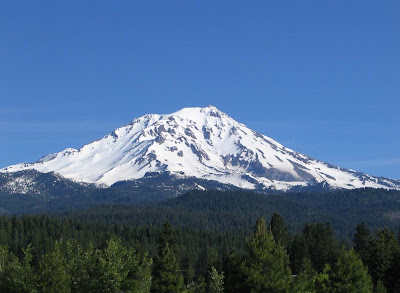
My Dad and I took a trip up to Mt. Shasta to make a late winter attempt on Avalanche Gulch. An extended melt/freeze cycle made me consider this route which is normally attempted in spring and summer.
I was surprised to see that, when we arrived at the trailhead Friday night, there was only one other car. It looked like we would have the mountain virtually to ourselves.
There was no moon while we slept at the trailhead, and with snow drifts falling high out of the sky, it was an eerie feeling not being able to see the mountain (and its weather).
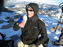
Windy Ascent to Helen Lake
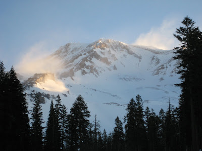
We started our ascent around 6:30am on Saturday morning. About halfway up to the lake, we met two skiers coming down. They had canceled their summit attempt due the high winds and said it was miserable at the lake.
They had a report from a climbing ranger that the winds at the lake have been high enough to snap four-season tent poles. Great.
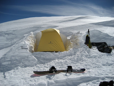
We pushed on to Helen Lake, and, when we arrived, we were all alone. We found the skiers' tent platform and began working to improve the windblocks.
After anchoring the tent with ice axes, snow pickets and ice screws, we decided to get in and start melting snow for water. Standing outside was miserable. We cooked up a hot dinner (chicken a la king) and went to bed.
Summit Day

We got up at five and began melting more snow, breaking down camp, and gearing up for the summit push.
As the first light began to hit the mountaintop, we could see the summit was covered in a cloudcap. Something to watch.
The ascent to Red Banks was one of the best parts of the climb. Falling rocks were whizzing by every minute or two.
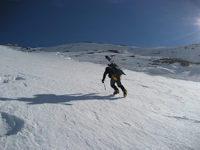
Most were small, but I guess that's why its called the bowling alley. A slip here has resulted in more than one person sliding over 1000 vertical feet.
A moment of routefinding ensued when we reached the top of Red Banks. Would we need to cross the Konwakiton Glacier? We had limited crevasse gear. Luckily we found a chimney through the volcanic rock that gave us access to the ridge.
From here, we powered up Misery Hill and crossed a high pass/plateau. Here we could see the impressive summit pinnacle (a fifty foot volcanic crag). Not seeing an easy way up, I attempted to climb an ice gully on the west side. Finding the ice loose and rotten, I retreated around to the north and found easier access.

The views from the summit were exceptional (that's my Dad in the summit photo). In the summit register, a group guided by Alpine Skills International was the only entry we could find for 2008.
Epic Descent
The descent was awesome. As we were hoping, the sun had warmed the top couple inches of the neve (snow/ice) we had ascended. This allowed us to set our edges well on the steeper sections around the Red Banks and provided a great (and long) descent down Avalanche Gulch to Helen Lake. From here, the slope eased, and we descended miles of an endless natural half pipe shaped gully (see the video below). Navigating by site, we were able to ride all the way down to the car!View the full album.
3 comments:
Awesome trip ! Hey, Matt, Matt, & Phil, I have a ton of great pic's you'd enjoy seein... specially the summit pic's... send your email or way to contact you...
jm
http://picasaweb.google.com/jemuno1/ShastaSummitMarch2008
Hello. This post is likeable, and your blog is very interesting, congratulations :-). I will add in my blogroll =). If possible gives a last there on my blog, it is about the SBTVD, I hope you enjoy. The address is http://sbtvd.blogspot.com. A hug.
Post a Comment