Aug 23, 2008

Mt. Conness - North Ridge

View Album

Had a fun trip climbing the North Ridge of Mt. Conness.

We left camp early and had reached the ridge before sunrise. After traversing the lower portion of the ridge, the climb begins as the ridge narrows with fun 4th class climbing up an arete on the first tower.

Read full post...

We traversed out onto the airy North Face past the top of the first tower. The exposure of the North face gets your attention in this section.

We kept a good pace simul-climbing the second tower. The descent from the second tower consisted of two rappels and a short chimney downclimb.

The final climb up the North Ridge was about five pitches of excellent quality fourth and fifth class climbing. Several portions of the route take you directly onto the knife edge ridge, where you climb hand over hand up the ridge while looking down the 1000+ foot vertical North Face.

View the full album. Summitpost info.

Mar 8, 2008

Mt. Shasta - Avalanche Gulch

View Album

My Dad and I took a trip up to Mt. Shasta to make a late winter attempt on Avalanche Gulch. An extended melt/freeze cycle made me consider this route which is normally attempted in spring and summer.

I was surprised to see that, when we arrived at the trailhead Friday night, there was only one other car. It looked like we would have the mountain virtually to ourselves. Read full post...

There was no moon while we slept at the trailhead, and with snow drifts falling high out of the sky, it was an eerie feeling not being able to see the mountain (and its weather).

Windy Ascent to Helen Lake


We started our ascent around 6:30am on Saturday morning. About halfway up to the lake, we met two skiers coming down. They had canceled their summit attempt due the high winds and said it was miserable at the lake.

They had a report from a climbing ranger that the winds at the lake have been high enough to snap four-season tent poles. Great.


We pushed on to Helen Lake, and, when we arrived, we were all alone. We found the skiers' tent platform and began working to improve the windblocks.

After anchoring the tent with ice axes, snow pickets and ice screws, we decided to get in and start melting snow for water. Standing outside was miserable. We cooked up a hot dinner (chicken a la king) and went to bed.

Summit Day


We got up at five and began melting more snow, breaking down camp, and gearing up for the summit push.

As the first light began to hit the mountaintop, we could see the summit was covered in a cloudcap. Something to watch.

The ascent to Red Banks was one of the best parts of the climb. Falling rocks were whizzing by every minute or two.


Most were small, but I guess that's why its called the bowling alley. A slip here has resulted in more than one person sliding over 1000 vertical feet.

A moment of routefinding ensued when we reached the top of Red Banks. Would we need to cross the Konwakiton Glacier? We had limited crevasse gear. Luckily we found a chimney through the volcanic rock that gave us access to the ridge.

From here, we powered up Misery Hill and crossed a high pass/plateau. Here we could see the impressive summit pinnacle (a fifty foot volcanic crag). Not seeing an easy way up, I attempted to climb an ice gully on the west side. Finding the ice loose and rotten, I retreated around to the north and found easier access.


The views from the summit were exceptional (that's my Dad in the summit photo). In the summit register, a group guided by Alpine Skills International was the only entry we could find for 2008.

Epic Descent

The descent was awesome. As we were hoping, the sun had warmed the top couple inches of the neve (snow/ice) we had ascended. This allowed us to set our edges well on the steeper sections around the Red Banks and provided a great (and long) descent down Avalanche Gulch to Helen Lake. From here, the slope eased, and we descended miles of an endless natural half pipe shaped gully (see the video below). Navigating by site, we were able to ride all the way down to the car!

View the full album.

Feb 16, 2008

Ice Climbing at Lee Vining and June Lake

View Album
Headed out to Lee Vining with the mountaineering club for some ice climbing. We got a big hotel suite split across about ten people.

The first day we headed out to Lee Vining canyon and climbed at Chouinard Falls. The second day a smaller group of us headed out to June Lake to climb at Horsetail Falls. We shifted our focus on to a north facing alpine route when the ice at Horsetail was clearly unstable. Read full post...

The second day at June Lake ended up being a lot of fun. The route we found had a water ice slope (with a crevasse at the bottom) which led up to a steep hard snow slope, followed by another section of vertical water ice.

Tom led the first section, followed by Will and then Ray, each progressively setting an anchor higher on the climb and then lowering or rappelling down. At the end of the day, Will built a v-thread and cleaned all the screws at the top anchor before rappelling down the route.

Feb 9, 2008

Mt. Tallac N Bowl

View Album
Kevin, my dad and I hit the trail before sunrise (5am) with the intent of easing our ascent on a frozen snowpack. Our route up was from spring creek road to the south ridge. Read full post...

We reached the summit by noon and started looking at different descent options (there are a lot). After scoping out the cross--which looked serious but good--we decided on the north bowl.

The descent was perfect. About 3500 vertical feet in perfect powder, constant sluffs on the steeper slopes but a generally stable snowpack. The top of the bowl is wide open and drops you onto another slope with light tree coverage. At the bottom of the bowl, we stayed to our left on the ridge and finished only minutes from the car.

Jan 19, 2008

Pyramid Peak Trip

View Album
Just finished a successful backcountry snowboarding trip up and down Pyramid Peak in Desolation Wilderness. Did the trip with my brother and dad.

We left later than ideal, which caused us to have to snowboard the second half of the descent by moonlight.

Jan 13, 2008

Thunder Mountain

View Album
Solo trip down Thunder Mountain. Little less than an hour hike from the Cornice chair at Kirkwood.

Jan 1, 2008

Round Top North Face

View Album
Trip Date: January 1, 2008
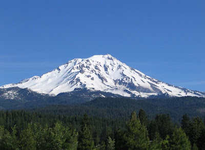
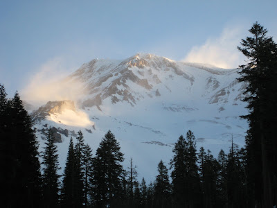
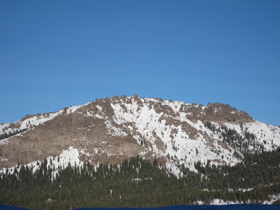
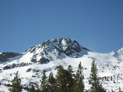
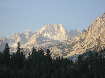
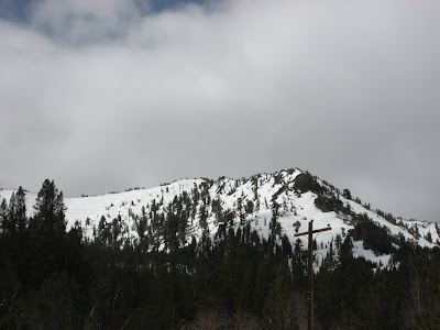
Mountain: Round Top
Location: Mokelumne Wilderness
Route: North Face (East Side)
Who: Solo

Trip Report:
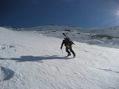
After a long night of partying till 3am, I awoke at 6am to get down to business. I drove over to Carson Pass, geared up, and left the car at 10am. I snowshoed approximately 4 miles to the base of Round Top with relative ease and felt good. I headed over to the base of the north face (east side) and cached my snowshoes and trekking poles at the base. Here I switched to crampons and an ice axe. Read full post...

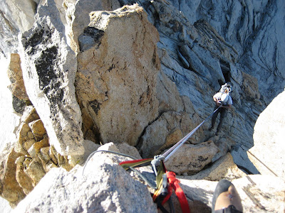
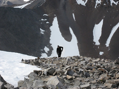
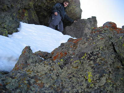
I began climbing generally solid snow and neve up the lower portion of the face. Further up I started to hit some rock bands with mixed climbing. About 150 vertical feet from the summit, I hit an impassable cliff band. From this point, I traversed to my left (east). I found and climbed a steep couloir that pointed left up to the ridge top.

Once on the ridge, I encountered some exposed mixed climbing on the face of the false summit. From the top of the false summit, I traversed west across the ridge-top towards the summit. The final 50 vertical feet up the summit block consisted of an exposed traverse across a neve slab just under the rock face with large cliff drops below. A fall from this point would likely end at the bottom of the mountain. From this point, 20 more vertical feet of rock and mixed climbing yielded the summit.

Once on the summit, I felt a large sense of relief and accomplishment after completing a route unlike any other I had previously done. I planned to head down the west ridge, a nontechnical route I had previously come up with my brother.

While traversing across the ridge along the top of the mountain, I spotted a new couloir heading down the north face pointing slightly to the west. I could see quite a way down the couloir, but could not determine whether it had an exit toward the bottom or ended with a cliff. I decided to descend this route hoping that it would reach the bottom or that I would find a way to traverse across the face to viable descent route.

I descended approximately 200 feet of steep but stable neve, where I encountered a rock and ice wall 6 feet high. Under this chute was another steep and narrow neve slope pointing straight down the face. I carefully descended the rock and continued down the neve slope. As I continued lower, I could see that the neve couloir ended with larger rock cliff below followed by a vertical drop of over 300 feet.

Realizing that I was now unable to continue descent, I carefully turned around with a heightened sense of exposure after looking at what remained below. I began climbing back up the neve slope where I soon ran into the rock and ice band I had descended. Now aware that several hundred feet of cliff lay just below me, I attempted very carefully to climb back up the rock band.

The snow slope I was standing on collapsed under my feet, and I was now left with a higher rock-band to scale with ultimate consequences if I were to fall. With no choice to go any other way, I made one attempt and backed off when I felt like I was losing control of the climbing. After gathering composure, I made another attempt and succeeded in clearing the cliff-band and anchoring my axe just above. I felt that I had taken it too far at this point, because the climbing was difficult enough that a fall felt like a real possibility, the consequences of which would certainly have been fatal.

After re-climbing the rest of the couloir, I descended the west ridge, traversed over to my cache, and snowshoed the four miles back in pitch black by headlamp.

Nov 10, 2007

Tuolumne Meadows Trip

View Album
Trip with Dad. Scouted out Cathedral Peak from the John Muir trial on Saturday. Got stranded in Lee Vining on Sunday due to highway 120 being closed (ice and snow).

Sep 30, 2007

Mt. Conness

View Album
Kevin and I. We arrived the day before our ascent and set up camp in a high meadow. It got cold at night even with five layers on inside a sleeping bag and tent.

The top ridge scramble was technically easy, but the exposure made it pretty exciting. Definitely a high sierra classic.

Aug 11, 2007

Matterhorn Peak

View Album
Grant, Kevin, Chuck, and I headed up the Southeast Slope from Horse Creek Pass route. This turned out to be a long outing for a single day. We camped out at Twin Lakes and took off in the morning. We followed a trail for a ways up into a meadow area that looked really good for camping. Read full post...

From this point, we deviated from the standard trail by cutting sharper to our right over a ridgetop. This made for a more interesting variation to the route, although it most likely did not save us any time.

After summiting, we began the long descent back to our camp. We made it back with the last light of day, 17 hours round trip.

Jun 23, 2007

Half Dome

View Album
With Matt, Dustin, Erika, Paula, and Shane. The second half of the trip got interesting when we found out Mullet had been eating only gummy bears the entire day. He bonked hard, and we finished in the dark.

Jun 10, 2007

Mt. Dana

View Album
Kevin, Dad, and I spent Saturday night at Sattlebag Lake. Kevin found a log that lasted through the night (and then some). We met Chuck at the trailhead at 7am sharp, and were off to a good (fast) pace. We only saw one other group the entire time we were on the mountain. We made it to the top after only 2 hours 20 minutes, which was much faster than I anticipated. Overall, a great trip.

Apr 29, 2007

Mt. Tallac

View Album
With Dad. We decided to turn around due to rapid warming of the snowpack causing surface instability.

Apr 21, 2007

Kirkwood Exploration

View Album
I decided to stay closer to Kirkwood (was planning to do Mt. Tallac) due to an incoming storm and the fact that I was solo.

Apr 7, 2007

Mt. Rose

View Album
The lesson from this trip: bad planning, preparation, conditioning, and timing add up to failure. Grant, Kevin, and I.

Mar 31, 2007

Round Top

View Album
Grant and Justin. Descended just east of the Crescent Moon Couloir (only 40 vertical feet from the summit). Great trip.

Mar 24, 2007

Red Lake Peak

View Album
First backcountry snowboarding trip. Grant and I. Perfect conditions going up, great snow going down. Had lasagna on the summit, almost got a third degree burn on my hand cooking it.

Mar 10, 2007

Crested Butte

View Album
Seven day trip to Crested Butte, CO with Grant, Chuck, and Mike on March 4-10, 2007.

We stayed in a nice hostel run by an insane lady. Got four good days of riding in and one super fun day of snowmobiling. Favorite area was Spellbound, an extreme limits bowl with steep runs through trees and rocks. Mike came through one night by climbing onto the second story in snow and ice when all four of us locked our keys in the room.

Crested Butte is an true mountain town with the best ski resort I've been to.